Earth Intelligence for

CLIMATE ACTION

Providing actionable insights for responsible land-use and water management

Solar Icon
Water Icon
Forest Icon

Life Lands

What is LiLa?

Solar Icon

Solar

  • User driven analysis to identify suitable lands
  • Automatic site suitability analysis considering ecological and social parameters
  • Key insights for the identified lands including water potential areas
  • Socio economic context for selected lands
Icon-02

Water

  • Meet sustainable water management targets.
  • Enhance water security in vulnerable areas
  • Plan water interventions for achieving net water positivity in rural areas
  • Identify best lands for ground water recharge and/or surface water harvesting
Forest Icon

Forest

  • Propose blue-green corridors based on existing forest connectivity including conservation/protected zones)
  • Workout green expansion – either outside current urban areas to balance the dense build-up or in populated spaces as urban forestry
  • Plan forest resilience based on terrain analysis, water potential, historical forest loss data and evaluation of risks such as cyclones, water stress and flood based hazards
  • Map out forest security based on socio economic data (Population, GDP & settlements)
Integrated

Integrated

  • Merges information and decision layers from Solar,Water and Water modules.
  • Identifies and informs best selected lands and related insights for Land use and resource management.
  • Supports data-driven planning for climate change mitigation and adaptation interventions.

SATELLITE IMAGERY PROCESSING

Our innovation lies in unlocking the productive potential of degraded lands by combining satellite imagery, public datasets and GIS mapping. We have an in-house land-cover algorithm that analyses satellite imagery across a year and assigns every pixel a land-cover class based on its recorded electromagnetic spectral signature. This way we can reliably identify lands that have been lying  barren over a certain period of time  or those that remain unused. We perform advanced terrain analysis based on digital elevation maps to understand the physical constraints and the true potential of a land with respect to its ecosystem as well the socio-economic context. This information is further fed to our suitability analytics for site rating and selection.

Our algorithms are scalable to any global region.

CUSTOM ANALYTICS

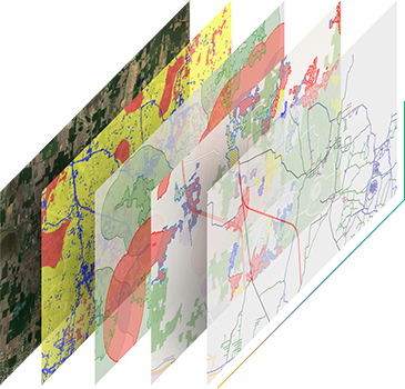
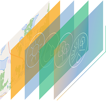
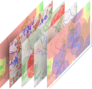
By analysing multiple layers of information at once, we provide a rapid and comprehensive assessment of a given region of interest in multiple dimensions. The potential of lands in terms of solar energy , sustainable water management, and ecological restoration is evaluated and provided as a visual layer. Rapid data-based insights are derived from streamlined algorithms that were developed using in-depth subject expertise. The tool enables decision-making with several integrated technology layers for extracting key performance indicators in order to optimise the selection to recommendation process.

APPLICATIONS

Our maps and data aid in planning:

  • Climate action
  • Reforestation programs
  • Transformation of degraded lands
  • Ecosystem restoration
  • Sustainable land-use
  • Sustainable rural development policies
  • Sustainable water management
  • Food security
  • Carbon sequestration
  • Climate risk mitigation and adaptation programmes etc.